


Description
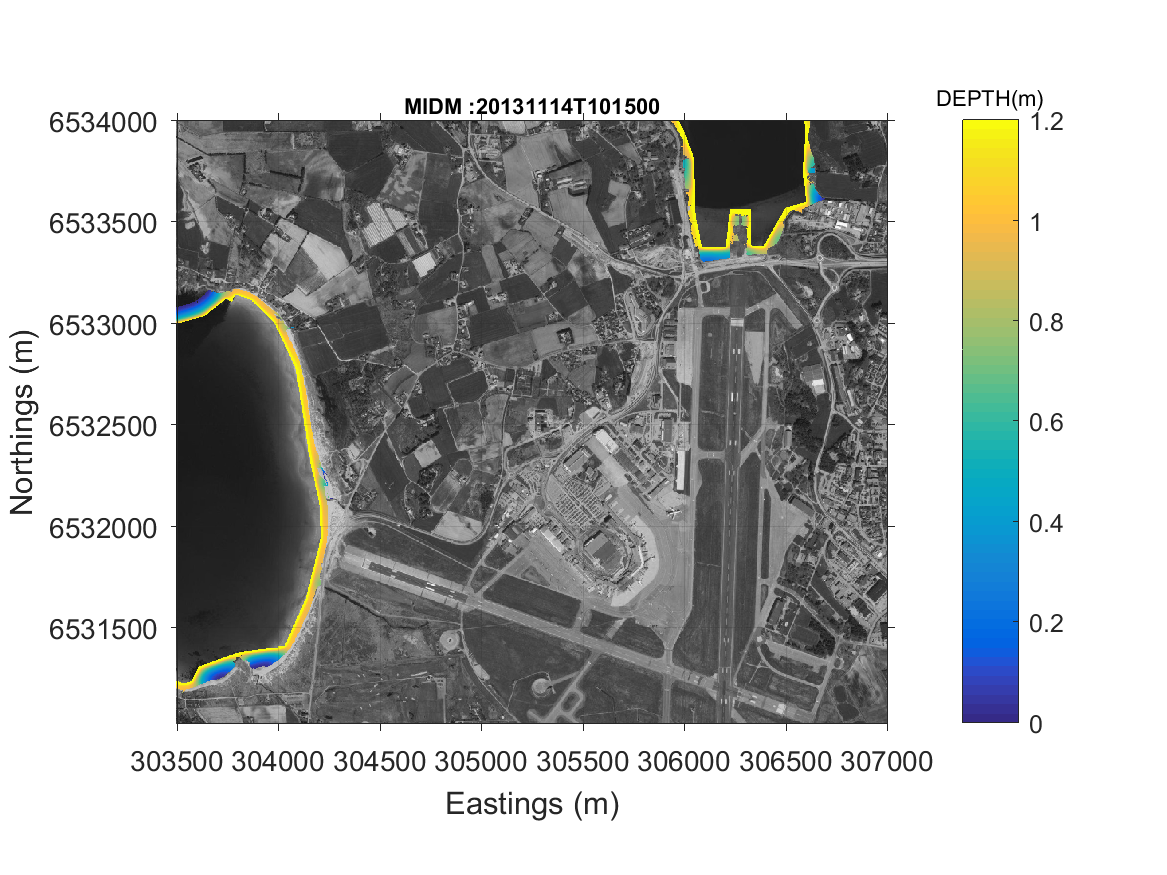
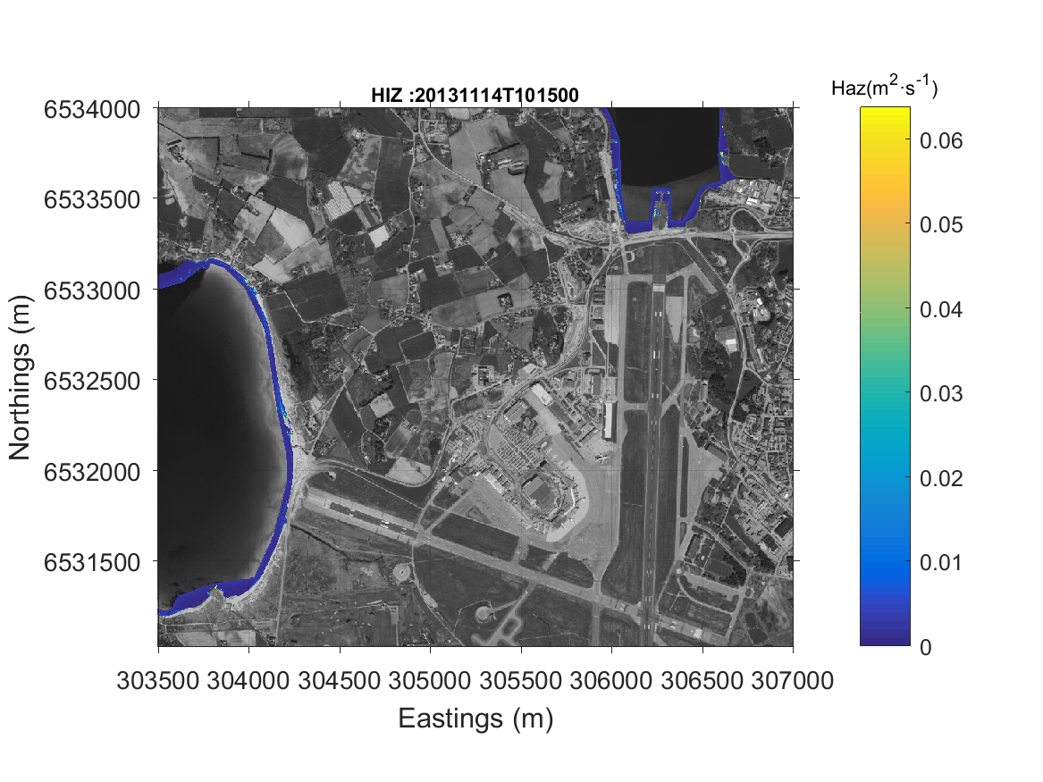
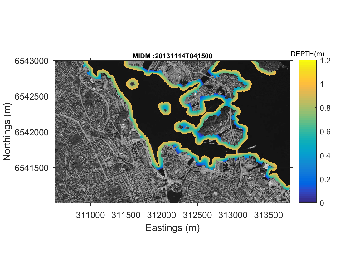
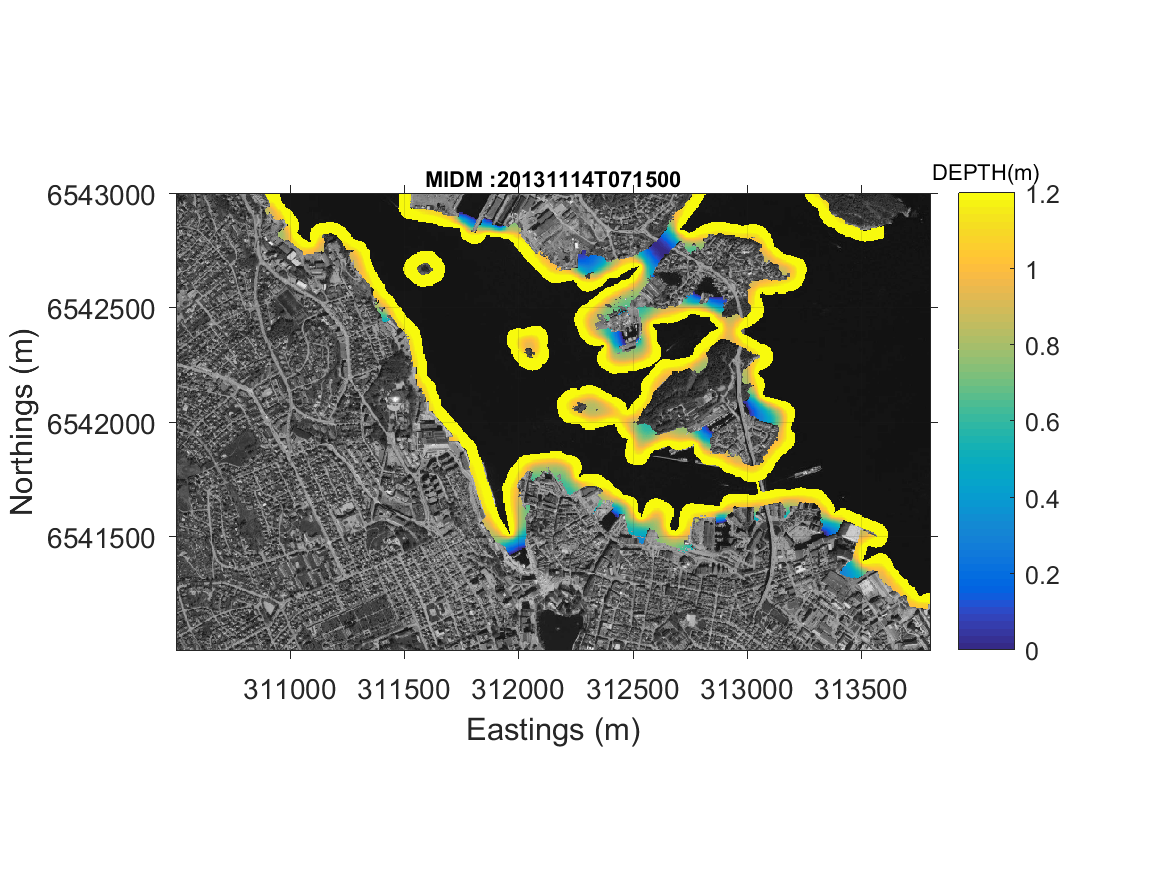
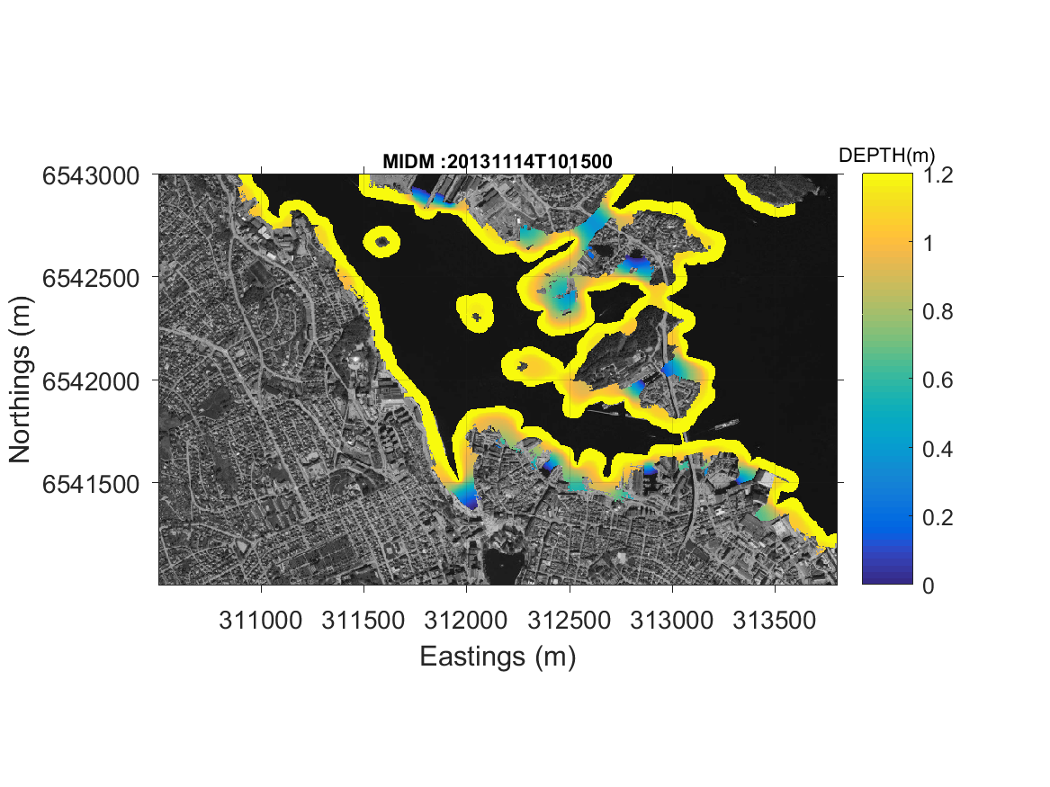
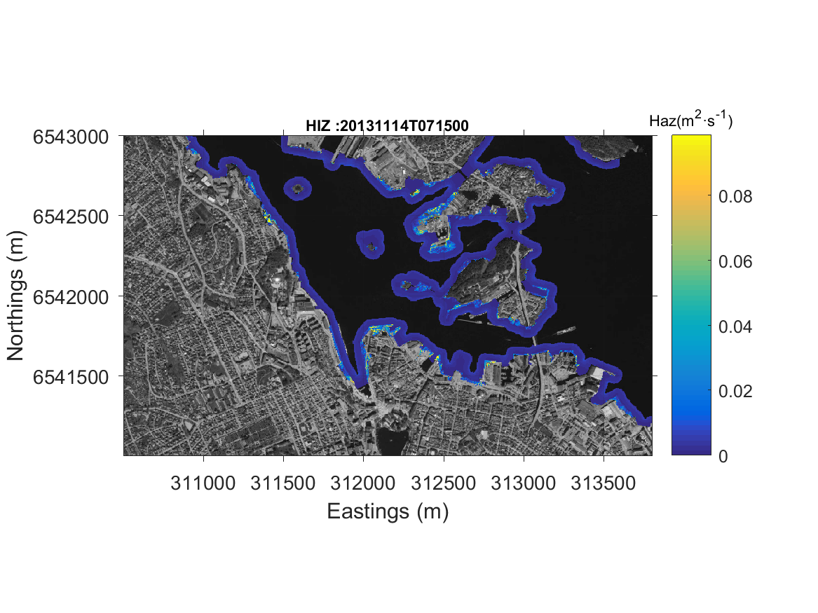
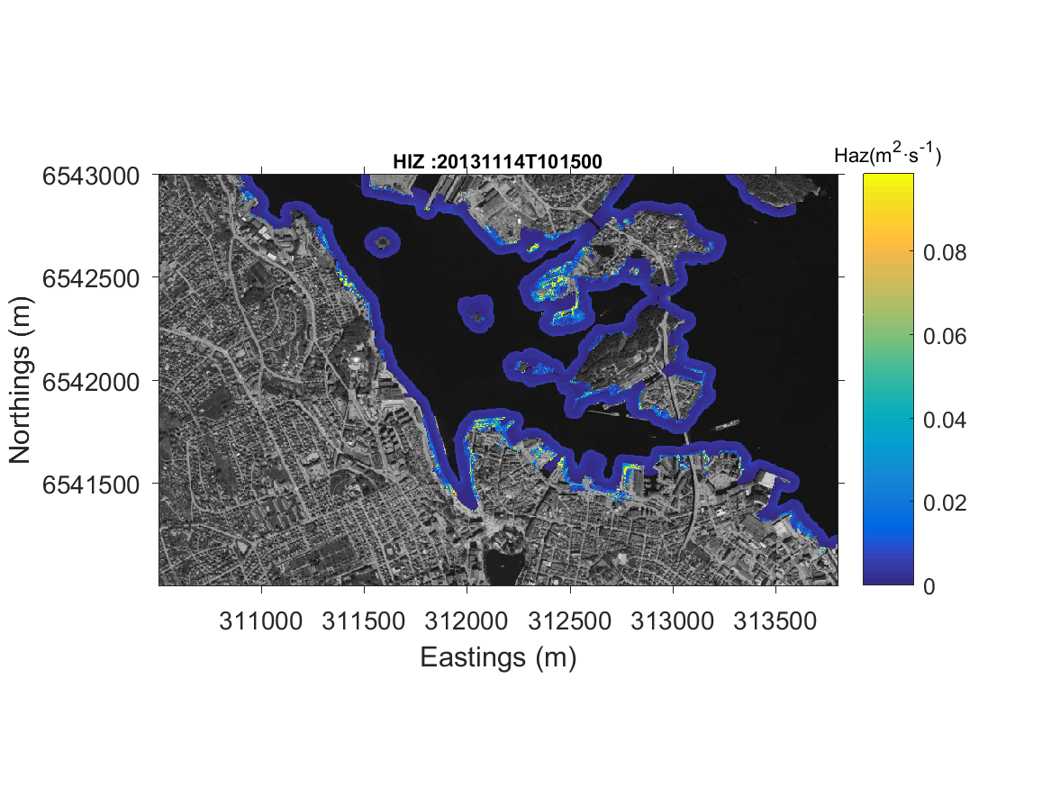
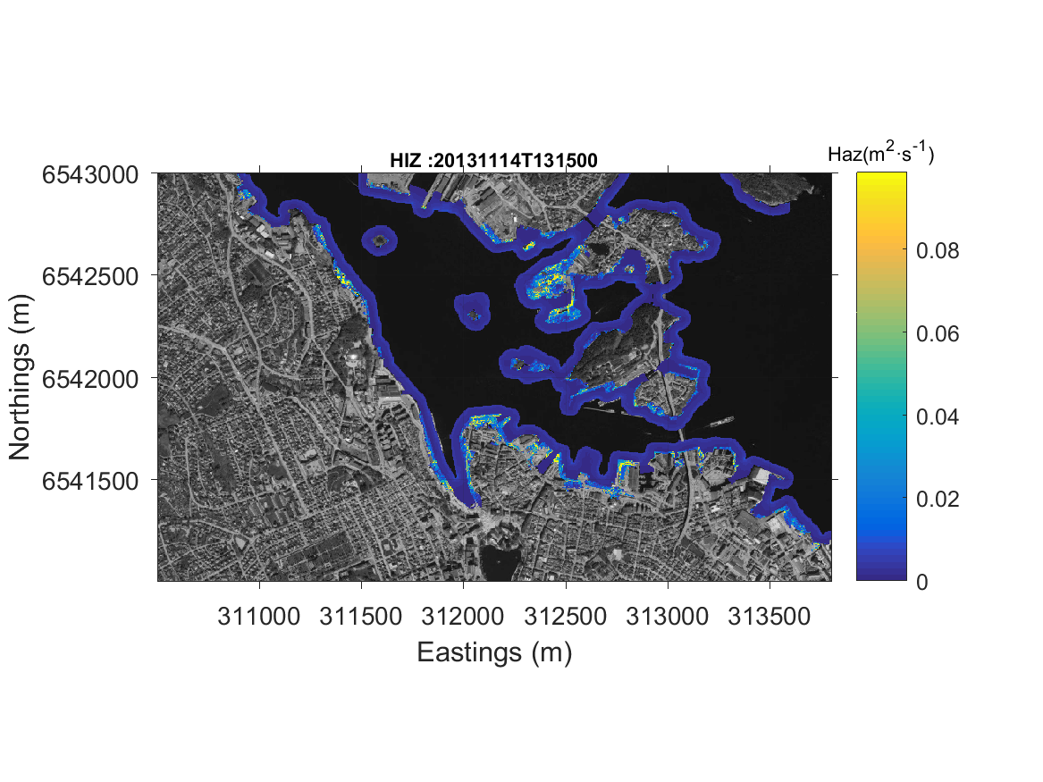
Maximum flow velocity and maximum inundation depth and flow severity category (based on velocity x inundation depth) in the landward area during the forecasted period.
- The Maximum Flow Velocity (MFV) computed in the landward area is a variable of the Erosion-Inundation model, computed with the Lisflood-FP model at a local scale, taking into account morphodynamics and coastline retreat in the erodible area. It is the maximum water velocity calculated each three hours. The velocity magnitude is represented in a colour map with bins in meters per second.
- The Maximum Inundation Depth Map (MIDM) depicts the level computed in the landward area, which is a variable of the Erosion- Inundation model, computed with Lisflood-FP at a local scale, taking into account morphodynamics and coastline retreat in the erodible area. It is the maximum water depth calculated each three hours. The maximum water depth is represented in a colour map with bins in meters.
- The Hazard Erosion Layer (HEL) is a variable that represent dry beach width or the distance from the water line to the first building or infrastructures located in a specific location in the area. The hazard level is ranked according to this distance. The hazard erosion layer is a variable of the Erosion-Inundation model, computed with the X-Beach model. The hazard inundation layer is represented as time series of the HEL coloured according to a predefined hazard level.
